
Skip to content
Permit Base Plans & LiDAR As-Builts BC

Permit Base Plans &
LiDAR As-Builts BC

Precision 360° LiDAR scanning and spatial documentation of existing conditions. Every successful home renovation, addition, and commercial Tenant Improvement starts with millimeter-accurate base building documentation.

The 4-Step As-Built Process

From setting foot on the property to handing over accurate files, here is exactly how we deliver your existing condition documentation.

StepKey ActivitiesPrimary Deliverable
1. 1. Scope DefinitionWe confirm square footage, property type, and required deliverables (standard 2D CAD spatial baseline vs. full permit modeling).Fixed-Fee Proposal
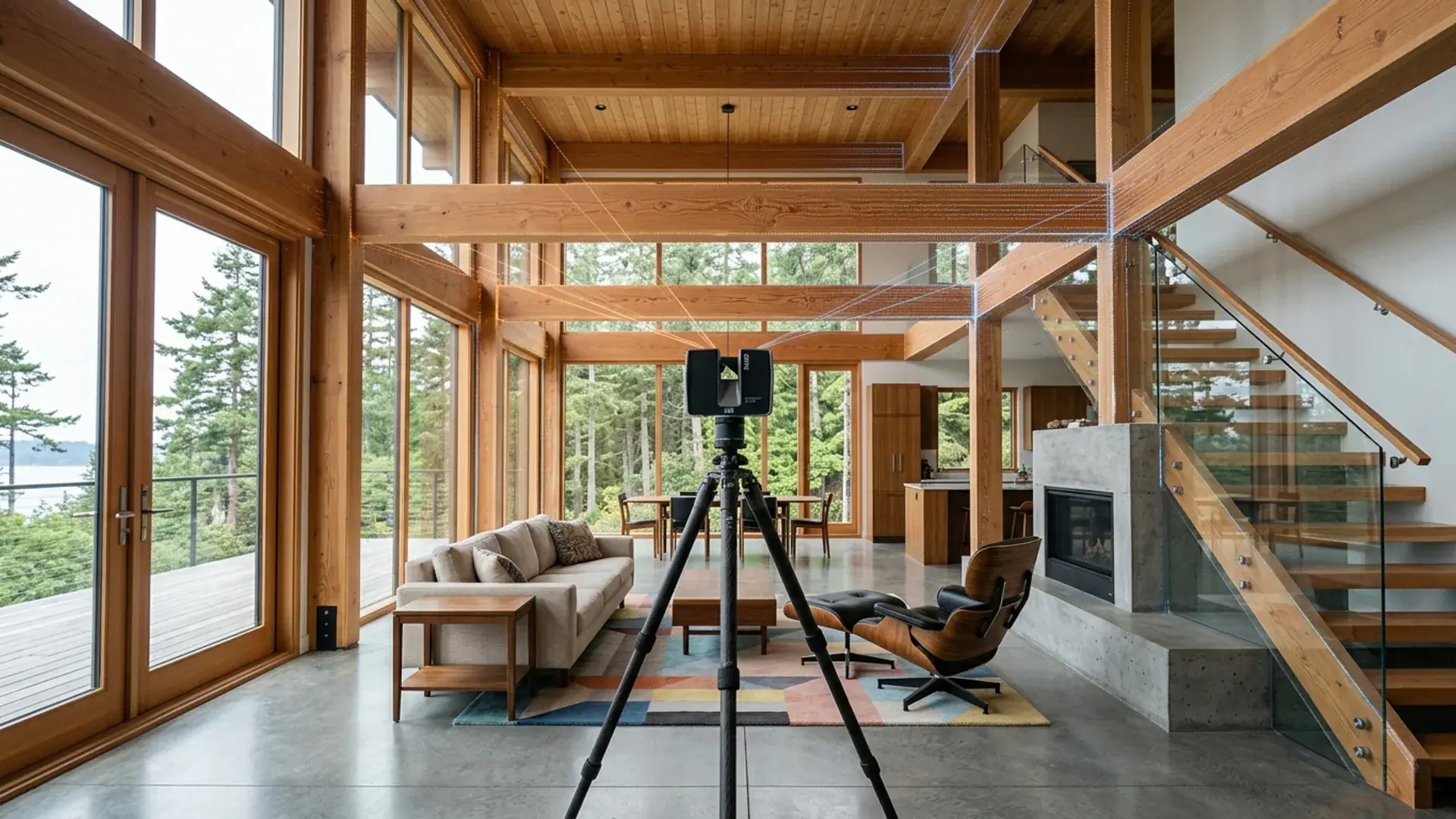
2. 2. On-Site LiDAR ScanOur technician captures high-density laser scan data across the interior and exterior perimeter, capturing millimeter-accurate spatial geometry.Raw 3D Point Cloud Data & 360° Site Scans
3. 3. CAD Processing & Spatial BaselineWe process scan data into 2D AutoCAD (.dwg) spatial baselines and dimensional PDF floor plans. If your project includes our full permit design package, we author complete 3D Revit permit models.2D CAD Spatial Baseline or Full Revit Permit Model
4. 4. Delivery (PDF/DWG & 360° Tour)We deliver final As-Built packages—including 2D DWG spatial exports, dimensional PDF floor plans, and 360° virtual tours—giving your design team the exact baseline to draft permit drawings.PDF Drawing Sets, AutoCAD (.dwg), 360° Tour

Project Roadmap & Scope of Work

Every successful home renovation, structural addition, and commercial Tenant Improvement begins with verified, millimeter-accurate existing condition drawings.

Using high-definition 360° LiDAR scanning, Canadian Blueprint captures existing spatial geometry, ceiling heights, wall assemblies, and structural spans to deliver reliable CAD exports, PDF plans, and full 3D BIM digital twins across British Columbia.

Select a phase below to jump to the details

  1. 1
    Scope Definition
  2. 2
    On-Site LiDAR Scan
  3. 3
    CAD Processing
  4. 4
    Delivery (PDF/DWG)

When Are As-Built Drawings Mandatory for BC Permits?

Permit Triggers

Municipal plan examiners require professionally drafted As-Built plans in four common project scenarios:

  • Missing Municipal Archives: Local city archives have no original blueprint records on file for older homes and buildings.
  • Past Unpermitted Modifications: Previous owners completed renovations without permits, causing existing city records to mismatch physical reality on site.
  • Structural Alterations & Wall Removals: Coordinating structural engineer Schedule B letters requires verified bearing point locations, post heights, and floor joist spans.
  • Commercial Change of Use & TIs: Landlords and municipalities mandate verified base building plans before reviewing mechanical, plumbing, and barrier-free accessibility layouts.

As-Built Survey vs. Legal Land Survey: Key Differences

Service Scope

Homeowners and contractors frequently confuse these two distinct services:

Feature / Scope LiDAR As-Built Base Plan (Canadian Blueprint) Legal Land Survey (BCLS Registered Surveyor)
Primary Purpose Internal/external building dimensions for renovations, additions, and TIs. Legal property boundary lines, easements, covenants, and building siting.
What It Measures Walls, door jambs, window headers, ceiling heights, stairs, plumbing chases, and beams. Property corners, iron pins, grade elevations, curb lines, and municipal setbacks.
When Required Mandatory for interior renovations, additions, suite legalizations, and commercial TIs. Mandatory for new custom home builds, subdivisions, and foundation siting.
Output Deliverables Dimensional PDF drawing sets, 2D AutoCAD .DWG baselines, and optional 3D Revit .RVT models. Stamped BCLS Legal Survey Plan, Topographic Site Plan.

Step 1: Scope Definition

Phase 01

We confirm project square footage, site access, and required deliverables (standard 2D CAD spatial baseline vs. full permit modeling) with an upfront, fixed-fee proposal.

Step 2: On-Site 360° LiDAR Scan

Phase 02

Our scanning technician captures full interior and exterior geometry, collecting millions of laser data points to eliminate cumulative measuring errors and missed skew angles.

Step 3: CAD Processing & Spatial Baseline

Phase 03

We process scan data into millimeter-accurate 2D AutoCAD (.dwg) spatial baseline files and dimensional PDF floor plans. If your project includes our full permit design package, our design team also authors complete, code-compliant 3D Revit models.

Step 4: Delivery (PDF, DWG & 360° Tour)

Phase 04

We deliver final As-Built packages—including 2D AutoCAD (.dwg) spatial exports, dimensional PDF plans, and interactive 360° virtual tours—giving your designer, engineer, or contractor the exact baseline needed to draft permit drawings and coordinate construction.

Ready to Capture Your Existing Conditions?

Get Started

Canadian Blueprint delivers millimeter-accurate 360° LiDAR laser scanning and permit base drawing packages for renovations and commercial tenant improvements across BC.

Canadian Blueprint Logo

Canadian Blueprint Inc.

BC Building Design & Permit Drawings

Back to As-Built Measuring
Sample Files

Downloadable Samples & Deliverables

Preview or download the actual digital assets and high-precision outputs we deliver for your project.

360° LiDAR Walkthrough

Interactive 3D

Capture every detail and virtually walk through your space. Perfect for remote design collaboration, layout verification, and contractor bidding.

Launch 3D Walkthrough

Real Estate & Dimensioned PDF

PDF Document

Comprehensive PDF floor plans, room dimensions, and fixture locations—ideal for property owners, designers, and project records.

Download PDF

AutoCAD .DWG Spatial Baselines

CAD Baseline

Automated 2D CAD geometry exported directly from scan data. Provides a millimeter-accurate spatial layout for architects, designers, and engineers to import, layer, and draft over.

Download .DWG

Building Permit Drawing Sets

Drafting Add-On

When paired with our building permit drafting service, we deliver fully drafted floor plans, window/door schedules, and structural wall callouts formatted for municipal permit submissions.

Download PDF
Next Steps

What to Send Us

To get an accurate quote for an As-Built measurement, please provide the following details:

Property Address

The full civic address of the residential or commercial property in BC.

Square Footage Estimate

A rough estimate of the floor area you need us to laser scan.

Required Formats

Let us know if you need standard 2D CAD spatial baselines, dimensional PDF reports, or full 3D Revit building modeling.

Intended Use

Specify if the deliverables are for internal design drafting, contractor bidding, or full municipal permit application.

FAQ

Frequently Asked Questions

Answers to common questions about 360° LiDAR scanning, as-built accuracy, pricing, and municipal permit requirements.

Still have questions?

Our team is ready to help clarify any details about your specific project.

Ask Us Anything

Let's Get Started

Take the next step in your building journey with our specialized design and permit services.

Residential
Homes, suites & outbuildings
  • As-Built Measuring
  • New Custom Homes
  • Home Renovations
  • SSMUH / Multiplex
  • Accessory Buildings & Garages
  • 3D Visualization
Learn More →
Commercial
Business spaces & TI
  • As-Built Measuring
  • Tenant Improvements
  • Change of Use Permits
  • Business Renovations
  • First-Time Business Setup
  • Commercial Space Planning
Learn More →